Back when I was a kid one of the family traditions, we had was decorating the Christmas tree on December 18th. Ok some years it might have been a day or two before the 18 but the 18 was the day on most years. That was the day my mother’s family had handed down to her through her parents’ family. I am not sure of what my dad’s tree decoration tradition was as I do not recall him saying much about it. Of course, putting the tree, they meant that you first had to go and get a tree. So that was a trip to where trees were sold. That would happen a few days before the 18th. At that time there were always many locations where one could buy a Christmas tree (a real one that is) So we would go to several tree lots and look over the tree selection trying to find the prefect tree. So, we would look over the trees for shape and lack of bare spots. It could not be too short nor too tall. Must have a somewhat straight trunk and when shook not drop too many needles. Once we picked out our tree, we would take it home and my dad would cut an inch or two off the bottom of the trunk and maybe a few low branches from the bottom. He would then put the tree in the tree stand and let it stand in the garage for a day or two. My mom would clear out a spot near the front window to place the tree. Then we would bring the tree in and place a white sheet on the floor (to make it look like snow?) and then we would bring out the lights and unravel them and then test them to make sure they still worked. Remember back then they were not the little lights we have now, but they were big lights that got real hot. Some sets were wired so that if one light burned out the whole set would not work. Then there were the ones that would work even with some of the lights burned out. After testing and replacing the lights that needed it then the lights were placed on the tree. Then the other ornaments were placed on the tree. Some of the ornaments were from my grandmother, my mom kept very good care of them. I still have many of my moms old Christmas ornaments of course the tree lights are now of the newer type. The tree once place would stay up until a day or two after New Year’s Day.
While there were artificial trees when I was young, they were mostly of the aluminum kind and you could not put lights on them so they had a thing that changed colors that would shine on to the tree. My dad did not like that kind of tree and he let everyone know it. I bought a new fake tree this year as the old one was more than 25 years old. This tree looks very nice and already had the lights on it. The tree has now been up since the 4th of December. If anyone has a Christmas tree tradition lets us know.
Here in Grand Rapids, there is a lest 1” of snow on the ground 55% of the time on December 18th The years I lived in Bay City there was a lest 1” of snow on the ground 43% of the time. And In Alpena there was at least 1” snow on the ground 86% of the time.
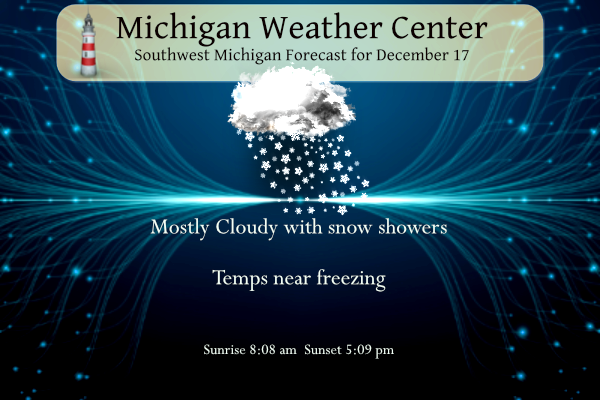
Lake effect snow showers will continue today, leading to slick travel and areas of reduced visibilities.
EARLY THIS MORNING
SNOW SHOWERS. NEW SNOW ACCUMULATION AN INCH OR
LESS. LOWS IN THE MID 20S. SOUTHWEST WINDS AROUND 10 MPH WITH GUSTS
TO AROUND 20 MPH. CHANCE OF SNOW 100 PERCENT.
TODAY
SNOW SHOWERS. SNOW ACCUMULATION 1 TO 3 INCHES. HIGHS IN THE
LOWER 30S. SOUTHWEST WINDS 10 TO 15 MPH WITH GUSTS TO AROUND 30 MPH.
CHANCE OF SNOW 100 PERCENT.
TONIGHT
SNOW SHOWERS. SNOW ACCUMULATION AN INCH OR LESS. LOWS IN
THE MID 20S. WEST WINDS 5 TO 15 MPH. CHANCE OF SNOW 100 PERCENT.
SUNDAY
CLOUDY WITH SCATTERED SNOW SHOWERS. HIGHS AROUND 30. WEST
WINDS 10 TO 15 MPH WITH GUSTS TO AROUND 30 MPH. CHANCE OF SN
DISCUSSION
(TODAY THROUGH NEXT FRIDAY)
ISSUED AT 347 AM EST SAT DEC 17 2022
— LAKE EFFECT SNOW IMPACTING TRAVEL THROUGH SATURDAY NIGHT —
NO CHANGES TO THE ADVISORY HEADLINES ARE PLANNED. ALSO, FORECAST
EXPECTATIONS ARE LARGELY UNCHANGED FROM BEFORE.
A PERSISTENT AND CONCENTRATED BAND SNOW BAND EXTENDED FROM KENT
COUNTY TO EAST OF SOUTH HAVEN. THIS IS LIKELY ASSOCIATED WITH LOW
LEVEL FGEN ALONG THE BOUNDARY BETWEEN LAKE MODIFIED AIR AND SOMEWHAT
COLDER AND DRIER AIR APPROACHING FROM THE SOUTHWEST.
IN SPITE OF THE COMBINATION OF THIS FORCING AND DECENT
THERMODYNAMICS ASSOCIATED WITH A DEEP LAKE MIXING LAYER…THERE ARE
STILL SOME FACTORS LIMITING THE FLUFF FACTOR TYPICALLY EXPECTED WITH
LAKE EFFECT SNOW. FIRST, STARTING ALOFT, WE ARE SEEING CLOUD TOP
TEMPERATURES AROUND -30C ASSOCIATED WITH THE STRONGEST NEAR-SURFACE
RADAR RETURNS. THESE COLDER TEMPERATURES FAVOR MORE OF A COLUMNAR
(INSTEAD OF PLATELIKE) HABIT FOR ICE NUCLEATION; THIS IS LESS
FAVORABLE FOR EFFECTIVE DENDRITE PRODUCTION IN THE DGZ. MOREOVER, WE
ARE SEEING A BULK OF THE VERTICAL MOTION UNDERNEATH THE DGZ,
RESULTING IN CONSIDERABLE RIMING OF FLAKES THAT WERE ALREADY SUB-
OPTIMAL FROM A DENDRITE PERSPECTIVE. THUS, WE ARE NOT EXPECTING
PARTICULARLY LARGE SNOW RATIOS – AND AS NOTED PREVIOUSLY, SNOWFALL
RATES WILL GENERALLY BE LIMITED, PERHAPS BRIEFLY ACHIEVING HALF AN
INCH PER HOUR IN SPOTS. 00Z HREF AND 06Z HRRR GUIDANCE SUGGESTS THIS
BAND WILL PERSIST UNTIL ROUGHLY 12Z, MAKING ADDITIONAL ACCUMULATIONS
OF A FEW INCHES POSSIBLE IN SPOTS.
DEEPER MOISTURE WILL PEEL OUT BY SUNDAY MORNING, LEAVING US WITH A
WINDOW FOR FREEZING DRIZZLE THAT SHOULD BE MINIMALLY IMPACTFUL GIVEN
ALREADY EXISTING SNOW COVER.
— LIGHT SNOW SHOWERS MONDAY NIGHT/TUESDAY MAINLY NORTH —
NO CHANGES TO PREVIOUS THINKING. AN UPPER PV MAX PASSING TO OUR
NORTH WILL BENEFIT FROM SOME LAKE ENHANCEMENT, RESULTING IN PERHAPS
AN INCH OR TWO OF ADDITIONAL ACCUMULATION, MAINLY ALONG AND NORTH OF
US-10.
— IMPACTFUL WINTER WEATHER WEDNESDAY NIGHT INTO FRIDAY —
ECMWF ENSEMBLES CONTINUE TO SHOW GROWING MEMBERSHIP OF WESTERN GREAT
LAKES SURFACE CYCLOGENESIS SOLUTIONS. THIS NUMBER IS NOW COMPARABLE
TO THE NUMBER OF MEMBERS GIVING AN NEW ENGLAND CYCLOGENESIS
SOLUTION. CYCLOGENESIS OVER THE WESTERN GREAT LAKES AS DEPICTED HERE
WOULD PRODUCE IMPACTFUL SYNOPTIC SNOW ACROSS MUCH OF LOWER MICHIGAN
FOLLOWED BY APPRECIABLE LAKE EFFECT SNOW. THE NEW ENGLAND OUTCOME
WOULD BE MORE FAVORABLE FOR PROLONGED LAKE EFFECT SNOW ACROSS OUR
FORECAST AREA WITH PERHAPS EVEN GREATER PENETRATION INLAND.
IN EITHER CASE, WE CAN EXPECT AN INCURSION OF SEASONABLY COLD AIR
AND PERSISTENT DEEP CYCLONIC FLOW THAT WILL KEEP A FAVORABLE
ENVIRONMENT FOR EPISODIC LAKE EFFECT SNOW INTO CHRISTMAS. THE ODDS
HIGHLY FAVOR A WHITE CHRISTMAS FOR OUR AREA THIS YEAR.
The official H/L yesterday at Grand Rapids was 33/27 there was 0.19″ of pricp of that 2.7″ was snow. For today the average H/L is 36/24 the record high of 54 was set in 2006 the record low of -5 was set in 1973 and the record snow fall of 5.4″ was set in 1951.
I just got home and I took a snow on the ground measurement and wow, I now have 12.5″ of snow on the ground. Grand Rapids will crush the old record for December 17th the old record was 5.4″ in 1951.
Slim
Absolutely incredible snowstorm and snowfall totals!
Grand Rapids broke a season daily snowfall record of December 17th pretty amazing for such a quiet week I must say .. INDY
Too funny – quiet week? Freezing rain, rain, wind advisory, 2 WWA’s, record breaking snowfall, dangerous roads and a major pattern change! This was one of the most active and eventful weeks this Fall/Winter! Some people have lost all credibility!
Indy, the Colts had an epic collapse against the Vikings, but a wild game to watch!
Still snowing! Incredible storm!
I’m up to a foot of snow here and still coming down heavy. Definitely more than I expected!
This will be a daily record for sure and maybe a December record! Wow just wow! We are over a foot in Rockford already!
Th GR point forecast as of yesterday was for GR to get around 4 to 6 inches! Big time overproducer!
Still snowing moderately! It has been snowing moderate to heavy all day long! Amazing snowstorm! The RDB seasonal snowfall prediction for GR is right on track! 85 to 95 inches baby! Wow!
The snow just won’t quite. Wow. What a start to winter. Still a lot of winter left to go!
…WINTER WEATHER ADVISORY NOW IN EFFECT UNTIL 11 AM EST SUNDAY…
* WHAT…Additional snow accumulations of 1 to 3 inches with
locally 4 inches of additional snow in some spots. Patchy
freezing drizzle is possible Sunday morning.
* WHERE…Portions of southwest and west central Michigan.
* WHEN…Until 11 AM EST Sunday.
Could be a record breaking snowfall today. We have a foot of snow! What a storm! Indy you are missing a monster!
I drove back to Grand Rapids to give my mom a ride home and wow what a difference. I had sun all the way to Clarksville then it clouded over. The snow began near the airport and the slick roads began after 28th st. Passed numerous accidents and slide offs. It’s a very greasy slippery snow. Hard to gain traction on the uphill slope getting off at Cascade Road. There’s a lot of snow in Grand Rapids. Back home now where the grass is still showing and roads are dry.
The snow has now stopped here. I just took a snow fall measurements and here in MBY I have a total of 10.5″ on the ground. There are some breaks in the clouds now and the temperature is now at 29.
Slim
I’m very surprised we do not have a warning, it has been snowing very heavily all day here. Looks like a winter storm. We might be able to catch to up average for December if next week plays out as expected
Definitely an over producer and Warning criteria! The snow just keeps coming and coming! What a storm!
Enjoy. The sun is peeking out here in Ionia County
I just took a snow fall measurement and here in MBY I now have a total of 8″ of snow on the ground. There is less snow on the driveway so the cement must still be rather warm. It is still snowing her with moderately good fake size. The snow that fell was at most times just light snow with some brief periods of moderate snow fall. At the current time there is light snow falling and the current temperature is 31.
Slim
We have been hammered with snow. So
far I am up to 7.5 inches!!!!! Incredible!
With reading I just took I now have 8″ in my yard.
Slim
Sold trees for Christmas every year, from a Church lot, for the Boy Scouts…”back in the day”. If I remember right, prices were getting out of hand when we charged $25.00 for a 7 foot tree. Our family made the switch from real to artificial out of convenience. Ada has 3-6 inches of snow throughout the yard this morning. This winter has everything in place to make a run for 100 inches. Should have made FL plans 🙁
Interesting to note the 12Z run GFS has come more in line with the ECMWF now for the storm next week showing heavy snow and very strong winds. Still plenty of time to change track, but bears close watching. Shows it deepening in the process from 974 millibars just east of MI to 960 millibars near Lake Ontario.
Does the track and intensity hold or is it just fantasy?
I used to cut my own trees from Christmas tree farms – there is nothing like the smell of fresh pine in the house. For the past several years we have had a fake tree as I don’t feel like slithering around on the cold ground to cut a live one. I am getting too old for that. I remember having the aluminum trees with the light carousel behind them in the 60s and 70s. My folks had one which I inherited in the mid-70s. One thing is for sure, young cats love to play in them with all the… Read more »
We used to get a real tree back in the day, but we just have a artificial now. Personally I like the artificial better
Drove my mom to work in Grand Rapids. She doesn’t like driving in bad weather so if I’m available I give her a ride. Roads are slick in GR. Over here my my house it’s just wet and the grass is still showing here. Maybe a half inch of snow. Not much.
After last evening when I almost slid into an intersection, I’m hesitant to head out today. I might be hunkering down this weekend 😀
Good plan!
Currently*17 degrees here in Minneapolis Minnesota with about 7 inches of snow in the city its coming to west Michigan… Can we say above average snowfall for December?? Stay tuned INDY
Here in MBY there is light snow falling and I now have 6″ of snow on the ground there is 3.5″ of snow on the driveway at the current time and the current temperature is 27.
Slim