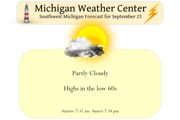
We have a cool start for today with a temperature at 5 am of 38°. Yesterday we reached 62° for the high and 45° for the low. While today will be cool and dry, a slow-moving storm system will bring periods of showers Saturday into Tuesday. Thunderstorms, though not severe are expected Sunday into Sunday night.
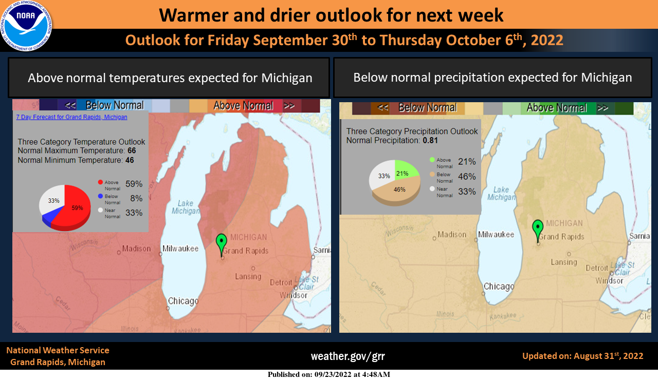
Here is the Climate Prediction Center’s 8 to 14-day outlook. This forecast shows that as we move into October at the end of next week, a warming trend with drier weather is expected.

The outlook for October is calling for a good chance of above-normal temperatures
Forecast Discussion
--Patchy Frost early, Fair weather otherwise --

Winds remain constant at about 2 to 5 mph overnight, with some
areas going calm. temperatures up north have dropped to 35.
Dewpoints have remained around 38 to 40. If dew`s remain above 35
with just enough wind, this will preclude frost formation.
However, it could allow for shallow ground fog this morning.

Any fog will dissipate shortly after sunrise as the atmosphere
mixes.

--Period of showers and possibly storms this weekend--

The ridge of high pressure that has given us pleasant weather
Thursday will shift eastward as a negatively tilted upper level
low will move through the upper mid west and through the Great
Lakes region this weekend. The negatively tilted trough will
protrude through the lower levels. A weak warm front will move
into the region Saturday. Current temps are still a tad low
currently and will adjust upward. Showers will be possible daytime
Saturday, especially north of the I 96 corridor. The cold front
will swing through late Saturday. An upper level jet streak that
will move over the Lower peninsula will be the driver of this
frontal pattern and should allow enough forcing for a chance of
thunderstorms Saturday night through Sunday afternoon. Any storm
formation will be dependent on frontal forcing as model soundings
show weak inversions, conditional stability and a lack of CAPE.
Showers, however, are likely though PWATS are only around an inch.
The total QPF through Sunday will be a half an inch or less.

--Showers continue through Monday--

The large closed low that will be dominating weather through the
weekend will shift to the east Monday. While we will be on the
backside of this low, successive troughs and copious amounts of
moisture will continue to stream into the region. The winds will
have shifted to the north, dropping temperatures. Rainshowers
will be possible as instability with this system will continue
Monday into Tuesday.
Back home in the Great Lakes State. It’s clouded up now but earlier this afternoon it was really nice out. Warm sun and a cool, dry breeze. I like this time of year.
The official low at Grand Rapids reached 38 that is the coldest low since May 8.
Slim
I had a low of 36 here in Comstock Park this morning. Pretty chilly start to the day.
Last year we stayed very warm through mid-October… we did not have any lows in the 30s until about a month from now. Although it does look like we warm up in about a week. Anything in the upper 60s to 70s will be considered average or above average.
Very cold start to the morning at my house. I have a current temperature of 34 degrees with frost this morning. Several degrees colder than I expected.
Yesterdays official H/L at Grand Rapids was 63/45 There was a reported trace of rain fall and 67% of possible sunshine. So far, the official overnight low at GRR is 42 here in MBY it was 39 and that is the current temperature here in MBY. For GRR that 42 is the coldest it has been since May 23rd that reading of 39 here at my house would be the coldest since May 8th For today the average H/L is now down to 71/50 the record high of 96 was set in 2017 and the record low of 28 was… Read more »