Once again we see the word ‘snow’ in our forecast and the Nordic gods laugh as they grudgingly give up a bit of their hoard from the Alpines (or not). We are still waiting for our first inch of the white stuff here in Allegan county, though if you added up all the trace amounts and the less than half an inch we have accumulated thus far we might come close to that allusive amount.
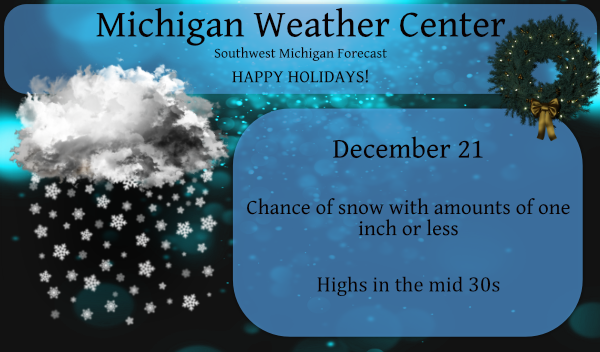
We will see temps in the low to mid-30s so we will more than likely see some rain mix in with any snow we happen to accumulate on the ground – I am not seeing any issues with the roadways as they will be just wet.
This is the NWS take on this system and the colder air moving in later this week:
The most impactful weather of the 7 day forecast will come later this week on Christmas Eve into Christmas Day. First things first though and we need to deal with the clipper moving through today. The system aloft can be seen as a healthy-looking shortwave plowing our direction from Minnesota. At the surface, the low is centered in Northwest Minnesota.
As is typical with clippers, the heaviest most concentrated precipitation occurs along and north of the track of the low. This clipper is no different with 1-2 mile visibilities common across far northern Minnesota. Models are pretty consistent in showing this snow moving in through the day and lingering into this evening. Feel some of the heavier snow will fall across Central Lower Michigan which will be closer to the track of the low.
Thinking snow today and tonight will be on the order of a dusting to 2 inches in most locations. The higher amounts of 1-2 inches will again be likely across Central Lower. As the DGZ becomes unsaturated tonight and lift remains in the low levels, we could see a bit of drizzle and freezing drizzle. Not a high confidence though in this occurring, but something to keep an eye on.
The mid to late week snow and cold has been well advertised for days, so I am not sure anyone is going to be caught off guard by it. Given much of the area has gone November and 3 weeks of December without significant winter weather I think most people are expecting snow/cold this time of year and it finally appears to be on its way.
That said, this is not an area-wide snow for sure. The main low moving through the region on Wednesday will track well to the north and west of Southwest Lower, so we will miss out on synoptic snow. Our area is set for a surge of Arctic Air and Lake Effect Snow. The time frame of concern starts Wednesday night and will last into into Christmas Day.
The first order of business is whether or not we see a flash freeze in the Wednesday night and Thursday time frame behind the cold front. The GFS is quicker with the front (Wed night) with the ECMWF slower (Thurs). In either event, I think we get dry slotted with plenty of wind behind the cold frontal rain. So, we will probably dry out a bit before widespread freezing of wet roads.
So that brings us to the cold and lake effect snow. The three main periods of concern for me are Christmas Eve, Christmas Eve Night and Christmas Day. Christmas Eve Night will probably contain the worst of the conditions. A trend in the models tonight are for slightly colder air to be moving through the area. That leads to very slick conditions in the in the favored west and northwest flow lake effect snow belts as air temperatures will be dropping through the teens, making salt less effective.
It is going to turn very winter like in the lakeshore counties and portions of the Highway 131 row of counties as well. Snowfall amounts have come down over the last several days and that is largely owing to the sharpness of the upper trough and its progressive nature. We never sit for a long time in a deep northwest flow with shortwave plowing through the area.
If I had to come up with snow totals at this time for a multi period event it would probably be on the order of 3-6 inches with some isolated 8 inch amounts possible. Those highest totals will be up in the northwest CWA towards Ludington, Baldwin and Pentwater and in the southwest from Pullman to South Haven to Bangor. Bottom line, the lakeshore counties will see impacted travel and cold air temperatures. Roads will be snow-covered and slick during a period of higher travel.
Conditions inland will be cold and blustery with some snow showers, but accumulations will be limited east of 131. The snow tapers off into Christmas Day and Christmas Day night as the deeper moisture quickly peels away to the east.
Can’t believe we don’t get any snow around here anymore, being in the snow business I’m gonna
Have to start looking at other things to do!!
I’m dreaming of a white Christmas it’s the most wonderful time of year ….INDY
👍
Winter storm warnings and advisories coming Christmas eve nuts…What a big difference a year makes …let it snow let snow let snow…INDY
Yup. A year ago we had over 8 inches of snow by now. This year we haven’t even had half of an inch.
YUP and 50’s 60″s on Christmas day in notaahh this year ….. snowy and cold ohh my lol..INDY
Looking at radar it looks like the precipitation is now past west Michigan and there was just a few sprinkles/flurries here at my house. So bottom line is no snow here and Grand Rapids seasonal total stays at 0.4″ The current reading here is 39 with cloudy skies.
Slim
I don’t think we even had 1 drop of rain yet here as everything outside is dry. Let’s extend that record!
Right around 5:30 we got some sleet late this afternoon as I was running errands around town.
Highs struggling to make 20* degrees on Christmas great artic blast …..INDY
Artic blast Christmas eve with snow who would of thought??? It’s the most wonderful time of the year….INDY
Entertaining…we’ve reached a notable length of time without receiving an inch of snow, on the same day we begin our devastating trudge to 104 inches. Ironic.
On a non weather note has anyone heard how Mark and his family are doing? it has been some time and no update. I hope everything is OK.
Slim
Thank you for your concern. Today is my first day back to work. I have been working remotely since March, so I do not need to actually go into the office, thankfully. I told my employer that I will do my best and see how it goes. My wife thinks I should delay my return, but I am loyal to my employer and our clients and I can’t help but feel guilty sitting on the sidelines even if I’m not 100%. Kudos to my baby boomer parents for instilling a good, honest work ethic. If I can get some work… Read more »
Glad to hear that you are feeling some what better. It sounds like you had a hard long run with this.
Slim
Yikes, sounds like two cases of Long Covid. Hope you two make a full recovery. That’s scary!
Thanks for the update Mark. Sounds like an absolutely brutal time you and your family have been through. Awesome to hear your friends and coworkers have stepped in to help! Hope you all get back to 100% soon!
Thanks for the update Mark and I appreciate your detailed description about your symptoms. You are lucky to be alive and I feel sharing these details will help those that still don’t believe it is real and won’t wear a mask! Mask up people! Good luck and continue to get better!
As Mookie and Barry have pointed out it is now December 21 and the total official snow fall at Grand Rapids for this winter season is just 0.4″ That means that Grand Rapids is now over 20 inches below average as of this date. While snow is in todays forecast the current temperature here at my house is 36 and the official reading is 34.
Slim
What a day to reach! The record for the latest 1 whole inch of snow ever! After 2 months of wish casting and going on and on about all the snow we were to get, here we sit with nothing. Definitely a bright spot in this dark year!
This is the least amount of snow that we have ever had through Dec. 20 in any winter. I love short winters!
NWS: limited snowfall accumulations later this week east of 131, overall snow totals have come down, this will not be an area wide snow