
We reached 90° again yesterday with a dewpoint of 62. We will reach the low 80s today with more cloud cover around. Chances of rain will be best this morning then a chance of a rain shower or storm this afternoon.
It is getting dry around the area, we have had 1.8 inches of rain this month – the last time it rained here was on the 13th with a tenth of an inch.
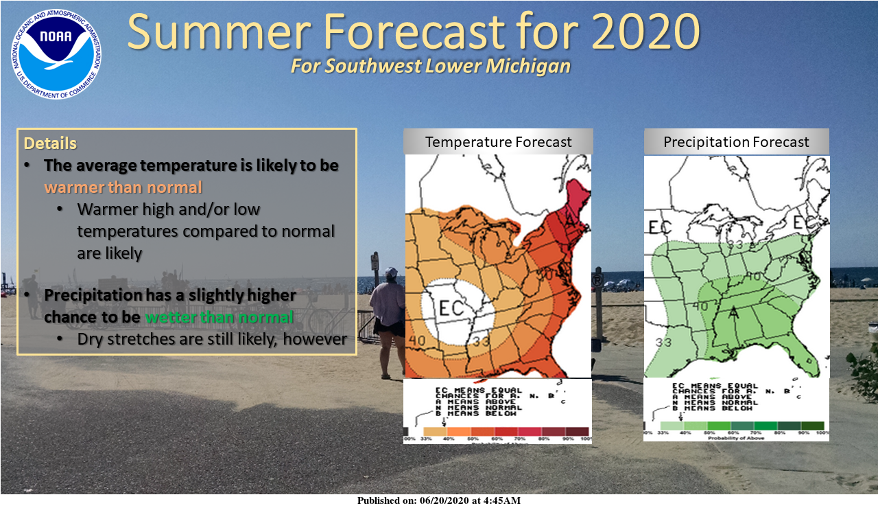
Above is the summer forecast from NOAA, not sure if I am in complete agreement with it however as with Slim I will reserve judgment knowing how long term forecasts play out.
Here is the hazards forecast from the NWS:
.DAY ONE...Today and Tonight

Scattered thunderstorms are expected today, most of which will be
from late morning into early evening, east of US-131. Any
thunderstorms will be slow moving so locally very heavy rainfall
is possible from these storms. Gusty winds area also possible from
these storms.

.DAYS TWO THROUGH SEVEN...Monday through Saturday

A strong cold front (for this time of year) will trigger
thunderstorms Monday, mostly during the mid to late afternoon into
the early morning hours of Tuesday. Gusty winds, and locally
heavy rainfall should be expected from the strongest of these
storms.

Afternoon inland thunderstorms are possible Wednesday and
Thursday. Then as the warm air pushes back toward Michigan a more
widespread thunderstorm event is possible Friday into Saturday.
73* degrees outside out at thee YARDofBRICKS NE of GR feels wonderful outside a night with the windows wide open and no fans!! loving the fact that there is no long lasting heat waves coming let’s keep it going it to Fall ….Happy Father’s day MV’s best have a good refreshing evening..INDY
Great weekend at the lake. Skiing, tubing, eating, and enjoying some adult beverages.
Mid 80’s again but at least there’s a breeze today. The past week has felt more like late July or early August than mid June. We could be in for a smothering hot Summer this year if this trend continues.
No rain here yet. We went up to Bay City yesterday to get some Michigan strawberries and on the way back home there was a heavy thunderstorm in Midland. The high in Bay City yesterday was 91. The Saginaw river is still high but Midland the water is now all down. Currently it is 76 here with a DP of 68 and the skies are cloudy at this time.
Slim
Not a drop of rain here, looks like the sprinklers will be coming out as the yard is slowly changing from green to brown. Yesterday was our 5th 90 degree day already, and the way the outlooks look there will be a lot more coming. When’s the last time we had 3 air quality alert days in a row in mid June?