Are Winters Getting Less Snow?
The last two winters West Michigan has seen less snow and have been mostly warmer than average. In looking back at the last 10 winters at Grand Rapids, Muskegon and Lansing. 6 have seen below average snow fall and 4 have seen above average snow falls. And while this winter has gotten off to a better start we now have fallen to near or below average snow fall for this date. And the rest of December looks to be very mild to say the least.
Of the 4 winters that had above average snow fall 2014/15 seen 31.0” of the 78.1” fall in November so just 47.1” fell the rest of the winter. In 2018/19 of the 81.3” that fell 14.1” fell in November and then 7.9” fell in March and another 4.9” fell in April so that meteorological winter just 54.4” fell. And just last winter would have been a record low snow fall total except that of the 41.1” that fell 28.5” fell in a two week period in February.
One of the reason why there has been below average snow fall the past few year has been for less Lake Effect Snow. So what is needed for good Lake Effect snow fall?
Lake effect snow from the Great Lakes occurs when warm lake water evaporates, and cold air currents slide over the lakes. Water retains heat more than air. This causes some open water in the Great Lakes to evaporate into the air and warm it. Rising into the atmosphere, this warm, wet air cools as it travels, turning into clouds that dump the frozen water on downwind land. As the cold air passes over the unfrozen relatively warm waters of the Great Lakes, warmth and moisture are transferred into the lowest portion of the atmosphere. The air rises, clouds form, and grow into a narrow bands that produces snow. Wind direction is also an indicator of which areas will receive lake effect snow. For example, heavy snow may be falling in Caseville, while the sun may be shining in Bad Axe. The physical barrier that Sand Point represents also has some impact on weather patterns on the south shore of Saginaw Bay.
Conditions must be absolutely correct for the formation of heavy lake effect snow to occur. Without all the elements in place, the chances of snow development are diminished. Here are the typical conditions for snow development. The lakes need to be open and relatively ice-free. The lake water also has to be warmer than the air above it so evaporation can occur. As the wind gently whisks over the warmer lake water it picks up the moisture and it rises to the upper atmosphere. If the winds are too strong, over 25 knots, then it can’t pick up great volumes of moisture.
As I said while this winter started out better that last winter. So far this season Grand Rapids is now at 13.1” For the season GR is snow just +0.8” but for December GR with 3.4” Grand Rapids is now -1.5 for the month. At Muskegon they are now -4.5” for December and -5.4” for the season. And at Lansing the they are now at 7.1” for the season that is +0.8”
As I am putting this together at 12:30 AM the temperature is up to 53 in Kalamazoo and 56 in Benton Harbor. Here at my house the temperature is now up to 44.
Slim
Forecast Discussion
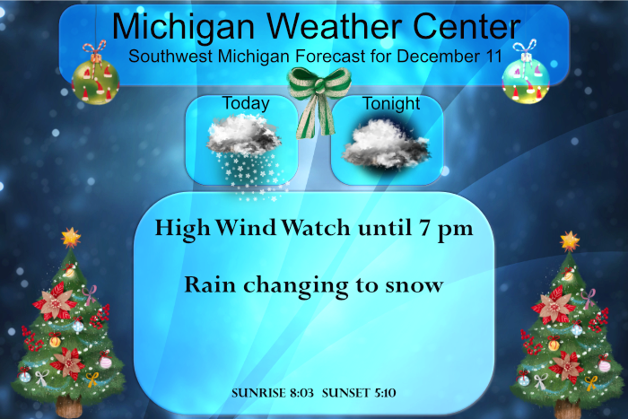
-High winds today, scattered power outages

We are still concerned about the possibility of a few brief wind
gusts this morning reaching warning criteria/60 mph but the
majority of the event today should have gusts to 45-55 mph, so
for now will stick with the advisory areawide. While the absence
of leaves on the trees may mitigate the extent of power outages,
wind gusts of this magnitude should result in at least scattered
outages today.

HRRR remains very bullish with the initial surge of cold advection
coming in from the southwest toward 12Z, showing 60 mph gusts
slamming into the lakeshore south of Whitehall, then possibly poking
inland/northeast through GRR. Fcst soundings support the possibility
of such values, with relatively steep low level lapse rates
helping to mix down 50-55 kt winds shown around 1000 ft.

Will continue to closely monitor this and may still consider a short
duration High Wind Warning this morning for a portion of the area
if confidence increases. Best threat at this time looks to be the
counties along the lakeshore from Muskegon southward, roughly
7am-10am.

After that initial surge of highest winds comes through this
morning, the peak gusts in the colder air/tight pressure gradient on
the back side of the departing deep system should be a little less
for the rest of the day.

Could still see a few tstms developing early this morning now that
sfc temps in the upr 50s (and mid 50 dew pts) are pushing in from
the south ahead of the apchg cold front. Also a brief burst of snow
showers is likely this afternoon as the deformation zone of the
system curls in over top of wrn Lwr MI and combines with some
some lake contribution as H8 temps continue to lower to around
minus 8C. It will be tough to get accumulations this afternoon
given relatively mild sfc temps in the mid/upr 30s, but some
localized one inch amounts are possible north of GRR/MKG this
afternoon.
The NAO and AO will both be trending negative by the end of this coming week = cold and SNOW! Bring it!
Still no power. A train hit some down power lines, which caused several power poles to snap. It’s a mess.
Just watched the press conference. Thirty poles snapped but the lines did not. I had no idea the lines were that resilient. All customers should be back up by 8, which is incredible. They’ll reroute the electricity to other grids. It will take 10-14 days to repair the poles/damage.
If that is the case it it much better than it could have been. It would be a real pain to go 10 days or more without power.
Slim
Can’t wait! We are taking our first day ski trip up to snow country tomorrow! Let’s keep this rock n roll snow party cranking!
Lost power 90 min ago. Estimated restoration is 8:30 p. Got a fire going in the fireplace and we’re playing euchre.
The only better would be a blazing snowstorm outside!
Let it snow let it snow let it snow…InDY
It is getting wild out here! Cold, wind, and light to moderate snow squalls! Incredible!
For anyone who likes the cold and snow here is todays post by Paul Pastelo from Auuweather “For many of the cities that rely on wintry weather across the northern Plains, Midwest, Great Lakes and Northeast, consistent warmth and a lack of snow have made the start to the winter season difficult. Looking ahead to the next two weeks, there isn’t much in the way of good news to pass along. The current United States snowpack looks rather bleak, with less than a quarter of the nation with snow on the ground, and looking ahead through the next two weeks,… Read more »
Great, because he is wrong more than 50% of the time, so we have a good chance of cold and snow hitting in a week or so! Bring it!
Lol….last I check most of Michigan is above average snowfall as of December 11th …especially the upper peninsula wow …InDY
Indeed many locations in Michigan are above average in snow fall. Many areas will lose a good week or more of snow fall in the upcoming week. Remember that is Paul Pastelo’s take and not mine. My take at this time is that it is too close to call.
Slim
After a high of 58 here before the cold front came thru there is now a rain/snow mix falling here with a temperature of 36. That is a drop of 22° after sun rise. The next week looks to be almost spring like with forecast highs in the 40’s and maybe a 60° day for good measure. For anyone keeping track the recorded high so far at Grand Rapids of 57 would be the 3rd warmest for any December 11th the record is 63 in 1949 and it was 58 in 1979 and 1899. The current forecast high of 61… Read more »
What wait a minute no way hu is that snow falling outside again?? lol….InDY
Yes more snow! Who knew? Very wintry pattern so far and the warm up next week should be short lived! Bring on the snow!
As of 11:30 AM, Consumers Energy says almost 130,000 customers are without power. If you add in Detroit-Edison and Indian-Michigan power outages, there must be around 200,000 total customers without power. That’s huge. The Kentucky tragedy is just awful. Nocturnal tornado outbreaks are the worst. Track of the main tornado is over 200 miles…estimate is 217 miles. May be longest tornado in world history.
Yep…was up late watching the trouble to our South. Rough storm system. I have a couple trees down this morning. Chainsaw fun this Spring 😉
I just got done sawing up a tree that fell on my fence, and fixed the fence – not fun weather for this – temp is now 37.
And….our Christmas lights are down. 😞
Get ready for the snow on back side of the front! It is going to wild!
Just hit 60 here. Wind is really starting to pick up. NWS upgraded the advisory to a High Wind Warning. It’s a good day to stay inside.
Sorry to hear about the tornadoes down in Kentucky. Here the temperature rose all night and reached 58 just before the cold front came thru. And boy there were some big time wind gust with that front. At this time it is still windy but no where near the gust that came with the front. The temperature is now down to 48.
Slim
We reached 59 degrees this morning – the wind is now howling and the temp is 49
56 here and the wind is increasing. There is standing water in the area so we must have received significant rainfall.
Thanks Slim! The lake effect snow dumps have definitely been missing the past several years. What used to be 8, 10, or 12 inch or more lake dumps has become lake dustings or an inch here or there. Makes a big impact on the season totals. Another factor is the past several years we have these extended warmups/thaws that last for weeks, even a month at a time. Years past there would be thaws, but never for more than a day or two.
58 degrees this morning. Perfect mid December morning!
At least 50 people are likely dead after multiple tornadoes barreled through southwestern Kentucky late Friday, according to Gov. Andy Beshear. “We believe our death toll from this event will exceed 50 Kentuckians, probably end up closer to 70 to 100 lost lives,” Beshear said at a briefing Saturday morning, calling the storms that hit the state “the most severe tornado event in Kentucky’s history.” Preliminary investigations indicate four tornadoes may have hit the state, including one that potentially stayed on the ground for more than 200 miles, Beshear said. Damage has been reported in at least 15 counties stretching… Read more »
Boy that sounds just terrible. People are not expecting something like that this time of the year.
I watched it on the Weather Channel last night. I couldn’t pull myself away from the coverage. When the tornado hit Mayfield, the debris signature on radar completely encapsulated the town. I listened to the scanner too. It was chilling.
There have been over 30 tornado reports so far across portions of six states
We have a temp of 55 degrees at 5:51 am – a nice spring-like morning! Rainfall is at .77 thus far.