We had a couple more possible tornados in eastern Michigan yesterday (not yet confirmed by the NWS), one near Port Austin in Huron County which damaged a pole barn the other in the Detroit area picked up two vehicles and flipped them over. In SW Michigan we had wind reports of 50 to 55 mph in south Ground Rapids from the storm which rolled through late yesterday afternoon and evening. Our main feature was the brief heavy rain and the thunder and lightning.
Our rain total here in Otsego was .44 of an inch yesterday bringing our July total to 2.99 inches and 11.99 inches for the summer. We had a high temp of 87° yesterday with the dew points in the mid-70s making for an uncomfortably steamy day.
One thing of note to keep an eye on will be cooler air moving into the state the first week of August, signaling our descent into fall, however, not to worry, we have plenty of summer weather left over the next couple of months.
Forecast Discussion
- Early morning fog

Already we are seeing dense fog expand along and around I-94 and
north of Route 10. Given the light winds behind the cold front,
and the mostly clear skies I would expect the fog to expand until
sunrise. The NAMNEST fog forecast shows just that. The RAP model
version of that is not as extensive as the NAM but it too shows
dense fog over a good part of the area.

Once the sun comes up, we should be able to quickly mix out the
shallow fog.

- Warm and Dry into Wednesday

I would expect warm and dry weather today and Monday. That is
thanks to shortwave ridging over our area behind the cold front.
The center of the surface high passes south of us Monday during
the day.

Since the polar jet is north of us, the front did not and will
not bring any significantly cooler air with it. It will lower the
dew point by 10 degrees or so through. There is a fair amount of
subsidence so the relative humidity from near the surface to over
300 mb should stay below 50 percent over this area into Monday
evening. That will mean even cumulus clouds during the day will be
limited today and Monday.

The next northern stream shortwave tracks north of Lake Superior
early Tuesday. That brings another cold front into northern lower
Michigan. It seems clear to me there will be showers and
thunderstorms with this. The trailing cold front will bring the
risk of convection as far south as I-96 in the afternoon but there
is still deep dry air in place so it will be hard to get to much
from that. Still we will have to put low chance for thunderstorms
due to this.

- Frontal wave brings convection Thursday

A stronger and more significant shortwave dives southeast later in
the day Wednesday, but more so Thursday. This will bring a frontal
wave into this area. This will be something like Saturday expect
this time the frontal wave (which was over northern Michigan
yesterday) will be over this area Thursday. That will increase the
risk of a widespread convection. This will have the Decent
surface based cape to work with and gfs model sounding show the
equilibrium level above 200 mb. Also we will have a stronger mid-
level jet streak closer to the event than we did on Saturday. So,
this will be the next event to watch for potential severe storms.


- Somewhat cooler but dry next weekend

All of the models agree that behind this front (Thursday) we will
get cooler air and it will be noticeably cooler. That is because
the polar jet gets real close to us this time, instead of still
being in central Canada like it will be today into Monday.

So here is what to watch for through for a little "weather fun"
in the long range. The ECMWF is taking the "Polar Vortex" and
displacing well south. In fact by Monday, August 2nd, it has 540
dm heights over southern Hudson Bay. That is the lowest height
over the entire northern Hemisphere in the model at that time. If
this truly does happen, we will get noticeably chilly for this
time of year, even for here. The ECMWF is actually forecasting
highs in the mid 70s for us the first few days of August. One
other aspect to this is that if this does happen we will be in
deep cold air, which means afternoon convection each day and maybe
land and water spouts. The GFS does not go along with this and it
should be pointed out that both models have been doing the same
thing for several runs. So it will be fun to see how this plays
out!
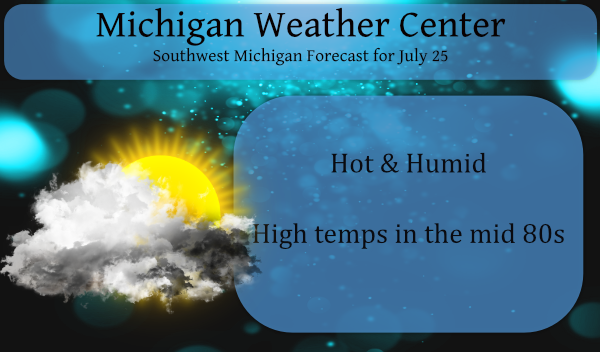
It sure has been a hot and humid weekend. Sounds like more of the same thru Wed. Then it will be nice and in the 70’s. It is hard to believe we are in the last week of July already. It has been a great summer for my tomato plants!
Still Severe Storm Free here at thee Yardofcues
Just over 3 quarters of an inch of rain here yesterday. All of which came in a very short time. Had enough wind to blow over one of our dead trees and it came down directly on the power lines to our house. Ripped the whole electric meter and everything else clean off our house. They came to repair it about 3 a.m., woke up the whole neighborhood with the chain saws. Fun times.
Yesterday afternoon there was a heavy but brief rain shower here. That shower dropped 0.32″ of rain in about 20 minutes. But once again there was no thunder here in my area. (so for me no thunderstorm) As of July 24 the mean at Grand Rapids for July is at 72.0 That is a departure of -0.8 from the new 30 year average. There have been only 8 days when the mean was above average 15 days with the mean below average and one day that the mean was average. The warmest so far this month has been 89 and… Read more »