
What Is a Weather Squall and How Does It Form?
You’ll notice a weather squall as sudden, fierce winds often paired with heavy rain and dark, ominous clouds.
Squalls form quickly within thunderstorms or along cold fronts due to rapid atmospheric pressure changes and strong updrafts.
These unstable conditions create powerful gusts that can last minutes to an hour.
As you learn more, you’ll uncover the warning signs, risks, and key safety steps to handle these intense weather events.
Understanding weather squalls is essential for staying safe during unpredictable storms.
By recognizing the signs and knowing what to do, you can be better prepared for nature’s sudden outbursts.
So, let’s dive into the world of weather squalls and equip ourselves with vital knowledge!
Definition and Characteristics of a Weather Squall
Although weather squalls may catch you off guard, they’re defined by a sudden, brief spike in wind speed lasting from a few minutes up to an hour.
When a squall hits, you’ll notice powerful wind gusts often exceeding 22 knots, sometimes soaring beyond 60 knots in extreme cases.
These intense bursts usually come with heavy rain and the roar of a thunderstorm, creating chaotic conditions that can change direction rapidly.
You’ll see dark clouds with flat bases looming overhead and might feel a sudden drop in temperature.
Squalls develop quickly, so you won’t have much warning before the winds pick up and the rain pours down.
Understanding these defining traits helps you stay prepared when nature decides to *unleash* these sudden storms.
The Formation Process of Squalls
You’ll notice that squalls often start with thunderstorms fueled by rapidly rising warm, moist air.
Wind shear then plays a vital role by tilting these storms, helping them organize and last longer.
Understanding these dynamics is key to grasping how squalls develop and intensify.
Thunderstorm Dynamics
When moist, warm air rises rapidly along boundaries like cold fronts or dry lines, it triggers the formation of thunderstorms that can develop into powerful squalls.
This lifting mechanism forces warm air upward, fueling intense thunderstorm activity. As the air ascends, condensation releases latent heat, which strengthens the updrafts and sustains storm growth.
Key factors in thunderstorm dynamics include the convergence of low-level winds. This convergence pushes warm, moist air to the level of free convection.
Vertical wind shear also plays a crucial role by tilting updrafts. This helps storms organize into lasting squall lines.
Additionally, the interaction between outflow boundaries and upper-level winds extends and maintains the squall system.
Understanding these processes helps you grasp how squalls form from intense thunderstorm activity along lifting mechanisms.
Wind Shear Effects
Because wind shear changes wind speed and direction quickly with height, it plays a vital role in shaping and sustaining squall lines.
When you observe strong vertical wind shear, you’ll notice it tilts storm updrafts. This allows thunderstorms to last longer by stopping downdrafts from cutting off the storm’s inflow.
This process organizes squall lines and helps develop bow echoes—curved radar signatures linked to damaging winds.
As wind shear interacts with atmospheric instability, squall lines intensify rapidly and maintain their strength.
Near the surface and aloft, horizontal wind shear influences cloud features like shelf clouds, signaling an approaching squall.
Understanding wind shear’s effects on wind speed and direction lets you grasp how it drives the formation and evolution of powerful squall lines and their associated severe weather.
Recognizing the Signs of an Approaching Squall

Although squalls can develop quickly, you can often spot their approach by watching for sudden shifts in wind direction and speed.
The wind may abruptly strengthen, signaling the squall’s leading edge is near.
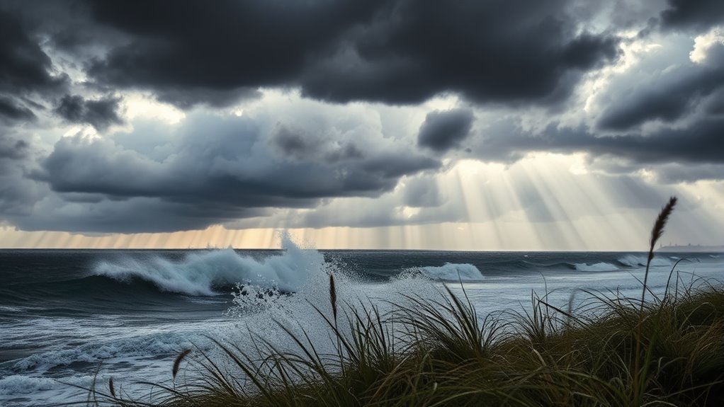
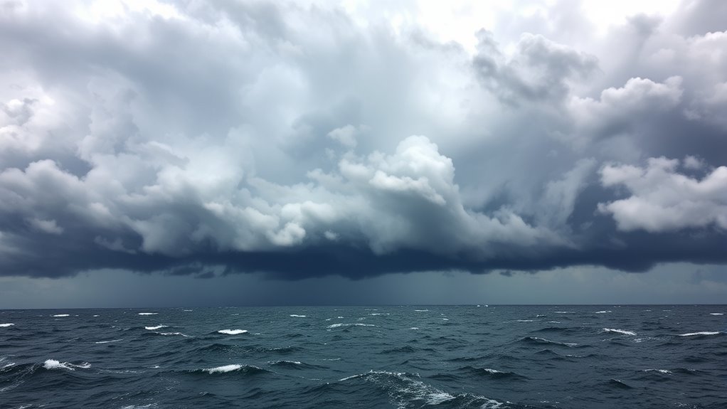
Keep an eye on the sky: dark, towering clouds with ominous bases often mark the squall’s arrival.
You might also notice shelf or roll clouds forming along the storm’s front.
Look for these clear signs:
- Sudden wind shifts and rapid increases in speed
- Tall, dark clouds with a menacing appearance
- Slanting rain streaks and whitecaps on water surfaces
Weather Conditions and Phenomena Associated With Squalls
When a squall hits, you’ll experience sudden strong winds and heavy rain that can make visibility tough and conditions dangerous.
Lightning strikes and hail often accompany these storms, increasing the risk of damage.
In some cases, squalls can even spawn tornadoes or derechos, which bring intense, widespread destruction.
Wind and Rain Impact
If you’ve ever experienced a squall, you know how quickly the wind can shift into powerful gusts exceeding 22 knots.
It can drastically alter the weather in moments. These intense winds often whip up whitecaps and churn the water into steep, choppy waves.
Heavy rain usually follows, reducing visibility and soaking everything in minutes.
You might also notice roll clouds looming, signaling the squall’s arrival.
Here’s what to expect during a squall’s wind and rain impact:
- Sudden, strong winds that can disrupt travel and outdoor activities.
- Torrential downpours that limit visibility and cause rapid flooding.
- The formation of whitecaps and roll clouds, warning signs of intensifying weather.
Understanding these signs helps you stay safe when a squall strikes.
Lightning and Hail Risks
How dangerous can squalls get beyond strong winds and heavy rain?
Squalls often bring frequent, intense lightning strikes that can number in the thousands per hour. This poses serious risks to you and your electronics.
The strong updrafts inside squalls lift moisture above freezing levels, forming hailstones often quarter-size or larger. These hailstones are capable of causing severe damage.
Wind shear and downdrafts can blow hail sideways, spreading the danger over a wide area.
Here’s a quick look at lightning and hail risks during squalls:
| Hazard | Impact |
|---|---|
| Lightning | Fires, electrical hazards, personal injury |
| Hail | Property damage, vehicle dents |
| Severe weather | Flash flooding, widespread hail impact |
| Squalls | Intense storms with lightning & hail |
Stay alert—these severe weather elements make squalls especially hazardous.
Tornadoes and Derechos
What makes squall lines especially threatening are the tornadoes and derechos they can release.
Tornadoes often develop quickly along squall lines, particularly within bow echoes.
In fact, about 25% of U.S. tornadoes originate from these severe thunderstorms.
Derechos are powerful squall line systems that produce widespread, straight-line winds exceeding 60 mph, sometimes reaching hurricane-level speeds.
When facing these phenomena, keep in mind:
- Tornadoes and waterspouts form rapidly within mesovortices along the squall line.
- Derechos generate damaging winds over hundreds of miles, causing massive destruction.
- Severe thunderstorms within squall lines unleash intense lightning and hail, increasing hazards.
Understanding these risks helps you stay prepared when a squall line approaches with its severe tornadoes and derechos.
The Impact and Risks of Encountering a Squall
Why should you be cautious when a squall approaches?
Because strong winds and heavy precipitation can hit suddenly, causing destructive winds that threaten your safety.
You might face wind gusts exceeding 50 knots, risking loss of control if you’re on a boat or driving.
The rapid onset of heavy rain reduces visibility, increasing the chance of accidents.
Lightning within squalls adds another layer of danger, while hail or even tornadoes can develop unexpectedly.
Squalls often form quickly along cold fronts or thunderstorms, catching you off guard.
Strong downdrafts and gust fronts can create hazardous microbursts and wind shear, especially dangerous for aircraft and ground transport.
Encountering a squall means facing severe, fast-changing conditions that demand your full attention to avoid harm.
Safety Measures and Preparedness for Squall Events
When a squall threatens, staying informed through reliable weather updates like NOAA Weather Radio is crucial to your safety.
Effective safety measures and preparedness can protect you from the dangers of high winds and sudden weather changes.
You should always seek shelter indoors or in a vehicle away from windows and tall objects to minimize injury risk.
Avoid outdoor activities and driving during a squall to prevent accidents.
To stay prepared, follow these key steps:
- Secure loose outdoor items to prevent damage or injury.
- Have an emergency kit ready with essentials like water, flashlights, and first aid supplies.
- Monitor weather forecasts continuously and heed warnings promptly.
Taking these actions ensures you’re ready to respond swiftly and safely during squall events.
Frequently Asked Questions
What Causes a Squall to Form?
You get a squall when warm, moist air rapidly lifts due to cold fronts or wind collisions.
This process is combined with strong wind shear and instability.
Together, these factors trigger thunderstorms and downdrafts, causing sudden, intense wind and rain bursts.
How Long Do Squalls Last?
Squalls usually last between 10 and 40 minutes, but they can be shorter or longer depending on storm intensity.
If you’re near a squall line, expect the winds and rain to stick around for hours sometimes.
What Is a Weather Squall?
A weather squall is a sudden, intense burst of wind that hits you hard for several minutes.
You’ll often notice heavy rain, thunder, and a quick temperature drop.
These elements combine to create conditions that are chaotic and challenging to navigate.
Is a Squall a Tornado?
You might feel a sudden gust like nature’s roar,
but no, a squall isn’t a tornado.
It’s fierce straight-line wind, lacking the tornado’s twisting dance,
yet still powerful enough to shake your world.
Conclusion
Now that you know what a weather squall is and how it forms, you can better prepare yourself when the skies darken suddenly.
Imagine you’re sailing and spot those sharp wind gusts and rapidly dropping temperatures—that’s your cue to secure everything and seek shelter.
Just like the sailors caught off the Great Lakes in 2018, quick action during a squall can make all the difference in staying safe and avoiding damage.
Stay alert and ready!
When you’re out on the water, awareness is key.
Weather squalls can develop rapidly, so knowing what to look for helps you respond effectively.
By understanding the signs of an impending squall, you can protect yourself and your vessel.
In conclusion, preparing for weather squalls is crucial for safety while sailing.
Stay informed, be vigilant, and take immediate action when conditions change.
Remember, a quick response can prevent accidents and damage during these sudden weather events.